

The property's deeds refer to a "Welcome Mine," the flat here carries the old name Welcome Flat, and three collapsed mining holes on the grounds are still there to back the story up. The historian Karen Dustman reports some evidence of a small Chinese camp near this bend of the river during the mining era, when the traffic ran over Monitor and Ebbetts passes. The record holds that thread only lightly so far, and this site will say more about it when the museum work is done.

Two government documents fix the origin of this ground, and both survive. In 1877 the United States surveyed the township and drew it onto paper — Markleeville, the East Fork, and Section 26, which holds the flat where the cabins now stand. Twenty-seven years later, on the strength of that survey, the General Land Office granted a hundred and sixty acres within that section — the south half of one quarter and the east half of another, river ground — to Thomas Audrain, in the name of President Theodore Roosevelt.

The 1877 survey — the full plat
Close ×
United States, Surveyor General's Office. Plat of Township No. 10 North, Range No. 20 East, Mount Diablo Meridian, California. Surveyed by P. C. Rector, W. H. Carlton and J. R. Glover, 1865–1876; examined and approved at the Surveyor General's Office in San Francisco, and received with the Surveyor General's letter of March 12, 1877.
Held today by the Bureau of Land Management, General Land Office Records (glorecords.blm.gov). A work of the United States federal government — in the public domain.
Section 26 holds the flat where the resort's cabins stand — a section is 640 acres, and the 1904 patent covers 160 of them: the south half of the north-west quarter and the east half of the south-west quarter. The East Fork of the Carson River runs the length of the township, past Markleeville. The patent was granted “according to the Official Plat of the Survey” — this plat.

The 1904 patent — the full record
Close ×
The document, set out as text
[Printed page number 408; form number (4—753 a.) at the head.]
THE UNITED STATES OF AMERICA,
To all to whom these presents shall come, Greeting:
[Certificate] No. 5162
Whereas [in hand:] Thomas [F or H — the hand admits either] Audrain of Alpine County California
has deposited in the General Land Office of the United States a Certificate of the Register of the Land Office at [in hand:] Sacramento California whereby it appears that full payment has been made by the said [in hand:] Thomas [F or H] Audrain according to the provisions of the Act of Congress of the 24th of April, 1820, entitled “An Act making further provision for the sale of the Public Lands,” and the acts supplemental thereto, for [in hand:] the South half of the North West quarter and the East half of the South West quarter of Section twenty six in Township ten North of Range twenty East of Mount Diablo Meridian in California containing one hundred and sixty acres
according to the Official Plat of the Survey of the said Lands, returned to the General Land Office by the Surveyor General, which said Tract has been purchased by the said [in hand:] Thomas [F or H] Audrain
Now know ye, That the United States of America, in consideration of the premises, and in conformity with the several Acts of Congress in such case made and provided, HAVE GIVEN AND GRANTED, and by these presents DO GIVE AND GRANT unto the said [in hand:] Thomas [F or H] Audrain and to [in hand:] his heirs, the said Tract above described: TO HAVE AND TO HOLD the same, together with all the rights, privileges, immunities, and appurtenances, of whatsoever nature, thereunto belonging, unto the said [in hand:] Thomas [F or H] Audrain and to [in hand:] his heirs and assigns forever;
subject to any vested and accrued water rights for mining, agricultural, manufacturing, or other purposes, and rights to ditches and reservoirs used in connection with such water rights as may be recognized and acknowledged by the local customs, laws, and decisions of courts, and also subject to the right of the proprietor of a vein or lode to extract and remove his ore therefrom, should the same be found to penetrate or intersect the premises hereby granted, as provided by law. And there is reserved from the lands hereby granted, a right of way thereon for ditches or canals constructed by the authority of the United States.
In testimony whereof I, [in hand:] Theodore Roosevelt President of the United States of America, have caused these letters to be made Patent, and the seal of the General Land Office to be hereunto affixed.
Given under my hand, at the City of Washington, the [in hand:] first day of [in hand:] December, in the year of our Lord one thousand [printed “eight hundred and” struck through, “nine” written above] hundred and [in hand:] four, and of the Independence of the United States the one hundred and [printed “four” struck through] [in hand:] twenty-ninth.
By the President: [in hand:] T. Roosevelt
By [in hand:] F. M. McKean, Secretary.
[in hand:] C. H. Brush, Recorder of the General Land Office.
[A blind seal of the General Land Office is impressed at the lower left; form number 6—742 at the foot.]
United States, General Land Office. Land patent to Thomas Audrain, Alpine County, California — 160 acres in Section 26, Township 10 North, Range 20 East, Mount Diablo Meridian. Certificate No. 5162, issued in the name of President Theodore Roosevelt, December 1, 1904.
Accession / Document Nr. CACAAA 071571. Held by the Bureau of Land Management, General Land Office Records (glorecords.blm.gov). A work of the United States federal government — in the public domain.
The middle initial is CONTESTED and this site does not settle it. The copperplate hand admits either reading; the GLO name index, the Vredenburgh California patent index and an independent by-eye reading of this same scan all give “H”. An earlier note here called the index’s “H” a transcription error — that was our assertion, not the document’s, and it is withdrawn. Register U40.
The camp took root around 1920 — "Since 1920," the resort has always said — in the years when the automobile first made a riverside fishing week an ordinary family's vacation. Mountain families lived in small cabins here on and off through the war years.
The Whitneys arrived in 1946, and the account of them comes from Jim Brune, who grew up here. There were four of them, and they ran the place as hunting, fishing and packing guides: they drove to central Nevada to bring back wild horses and trained them as pack animals, added a gas station, assembled four mail-order cabins from the Sears & Roebuck catalog, and kept exotic chickens for fly-tying feathers. A local fly called the "Carson King" still carries the river's name. A fire in 1947, ice-jam high water and the floods of 1950 drove them back to Sacramento.


Ownership changed hands in the decades that followed. Phil Elfstrom took over in February 2018, bringing a Michigan ice-fishing childhood, seventeen years in banking at MBNA in Florida, a move west when the bank sold, and a career in the death-care business. He collects local history, stays off social media and answers his own phone. His line about the place: "The more you are here, the more you want to be here."
Regulars ask about two things, and Phil settled both at the front desk in September 2026. The founding year is 1920, exactly as the sign has always said. And "Todd" — the name longtime guests still drop — was the manager who ran the place before Phil bought it.
The guest book keeps the rest of the account. People who learned to fish here as children bring back their own children; the entries run to third-generation regulars, forty- and fifty-year streaks, and families who have come every summer since 1985.
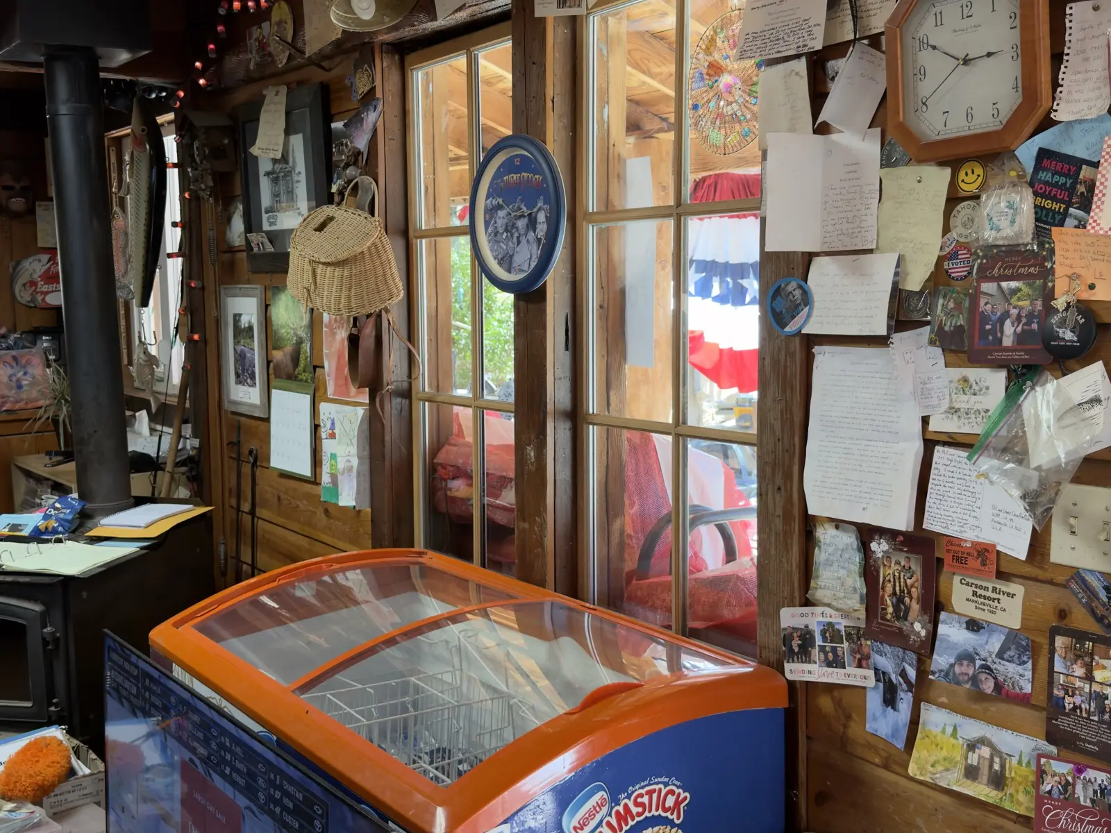
When the Tamarack Fire forced the property to evacuate in July 2021, reached the highway here and jumped it, the cabins came through. The centennial party, already postponed once by the pandemic, was finally held in July 2022 — a hundred years, two years late.
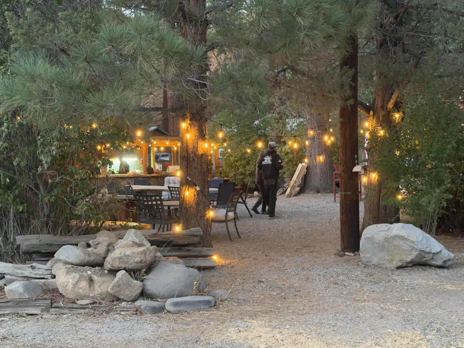
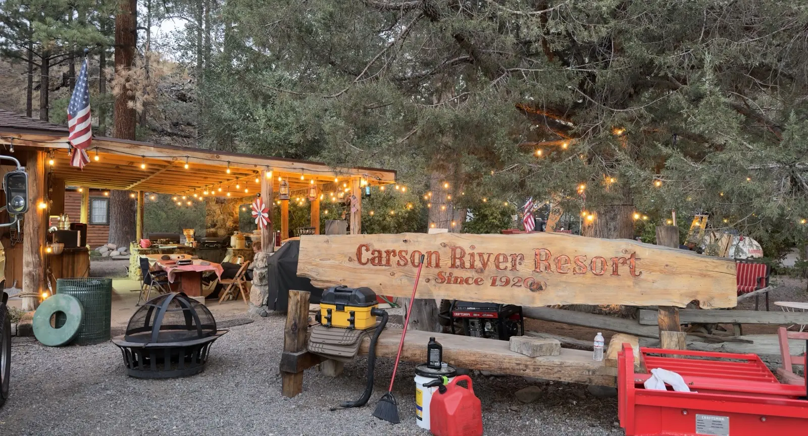
The book is open at the front desk, and Phil answers the phone.