
The season is short, and some years there isn't one
This is the first thing to know and almost nobody says it.
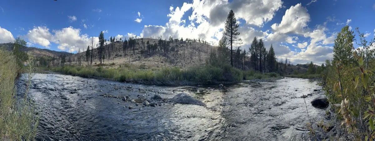
The East Fork is free-flowing — no dam controls it — so it runs on snowmelt and nothing else. That means roughly April to early June, and it means the season is a different length every year.
What the gauge below Markleeville actually recorded:
- 2021 — May averaged 498 cfs, below the 600 that rafts want. There was effectively no season.
- 2023 — May averaged 2,776 cfs, and July was still running 1,328. Four months.
- 2025 — April 594, May 917, June 464. About six weeks.
Rafts want somewhere between roughly 600 and 4,000 cfs; kayaks will go a little lower. Flows run highest in the morning, which is snowmelt arriving on a delay. The gauge is USGS 10308200, and it is the one every outfitter watches.
On 29 August 2026 it was reading about 60.
The run
Nineteen miles, Hangman's Bridge to the take-out above Ruhenstroth Dam, dropping about 25 feet per mile. Class II+, with a III in it. Most people take two days and camp; one long day is possible.
American Whitewater's own caution is the honest description, and it is worth reading twice: the rating undersells it in two ways. The water is very cold — it is snowmelt in spring — so a swim is a hypothermia problem, not an embarrassment. And the rapids are not hard but they are continuous in the early miles, with the current pushing constantly toward one bank or the other, and those banks are undercut cliffs in many places. It asks for steady manoeuvring rather than skill in bursts.
One rapid is named consistently across the sources: Sidewinder, roughly halfway down. Sources disagree about its exact mile and its class, and they disagree with each other about every other name, so we will not list the rest.
The take-out is not optional. Below it sits Ruhenstroth Dam, thirty feet high and breached in a 1997 flood, leaving what a Douglas County fire official described as an underwater debris field of broken concrete and rebar. People have drowned there. Get out where the Forest Service says to.
Permits: almost none, and one nobody mentions
No float permit. No quota. No launch limit. No group-size cap. Portable toilets are not even required, which is unusual — there are toilets at the put-in, at the take-out, and one about halfway down.
But the take-out is in Nevada, and Nevada requires an Aquatic Invasive Species decal on every non-motorised vessel — $6, annual, from NDOW. Almost no rafting page mentions it. It is the one thing that can actually bite a private boater on this run.
Ignore anything you read about an Alpine County permit system operating from May to September. It is on the internet, it is on an outfitter's blog, and it does not exist.
Don't filter below Bryant Creek
At about river mile 11, Bryant Creek brings acid mine drainage into the East Fork from the Leviathan Mine — a federal Superfund site where Anaconda took half a million tons of sulphur out of an open pit between 1953 and 1962. The water still oxidises what was left behind.
Take your drinking water from above that confluence.
Who runs it
Three outfitters hold Forest Service permits for this run — these three.
Tributary Whitewater — 530.626.7385 — sells a two-day, one-night trip at $450, and meets its guests here at nine in the morning. Their own page: "If you stay at the resort, parking while on the river is included, a $25/vehicle savings."
Tahoe Whitewater Tours — 530-587-5777 — runs it as a full day, four and a half to five hours on the water, $165.85 adult.
Current Adventures — 530-626-3363 — kayak-focused, $425.
For private boaters, two shuttle services work this run: River Rats, 775-901-6492, and Family Shuttle Service, 530-694-2966. The shuttle is about 25 miles and 40 minutes each way, which is the real reason to use one.
The statute drew its line at our bridge
In 1989 California designated this stretch under its own Wild & Scenic Rivers Act, and the statutory description is exactly the run: "The East Fork from the Hangman's Bridge crossing of State Highway Route 89 to the California-Nevada border."
That is a state designation. The Bureau of Land Management has found three segments eligible for the national system, which is a different and lesser thing — so if you see this called a National Wild and Scenic River, that is wrong.
What is true, and unusual: no dam stands on it between the bridge and Nevada, and no paved road touches the canyon. Two rough four-wheel-drive tracks reach the bank at the hot springs about halfway down, and no vehicle may cross the river there.
The hot spring at river mile 8.6
There are stone pools on the bank at about river mile 8.6, and they are the reason the two-day trip exists.
They are also unauthorised structures — built up by the public over years, periodically dismantled by the Forest Service, and rebuilt again. As of September 2026 the pools are open and usable. What you find depends on what the river and the last party through have done to them, so treat the soak as a bonus rather than the plan.