
If you drew an X-8 tag, you hunt from Saturday, Sept. 26 to Sunday, Oct. 11. If you didn't, there is no tag to buy this year — X-8 is Premium, drawn only.
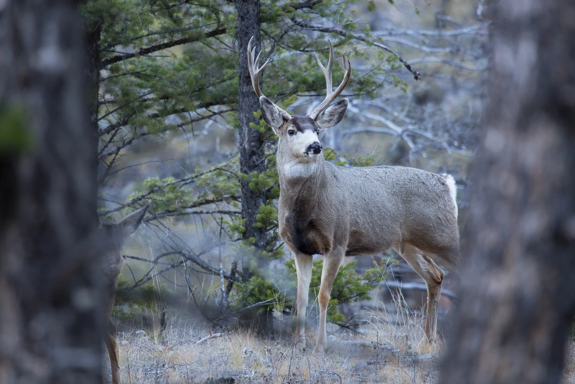
A Rocky Mountain mule deer buck in November, antlers hard. Photograph: NPS/Neal Herbert, Yellowstone National Park, 2016. Public domain.
The season
The general season opens on the fourth Saturday in September and runs sixteen consecutive days — in 2026, Saturday, Sept. 26 through Sunday, Oct. 11. The Department prints the formula rather than the dates, so check them against its 2026 Big Game Hunting Digest before you travel.
Where the zone is. X-8 takes in parts of Alpine and El Dorado counties, and Markleeville is inside it. As the regulation draws it:
- North: Highway 50, from the Nevada line west to Echo Summit
- East: the Nevada line, down to Indian Springs Road, then south to the Alpine–Mono county line
- South: the Alpine–Mono county line, west to the Sierra crest
- West: the Sierra crest and the Pacific Crest Trail, from near Wolf Creek Pass north to Echo Summit
The tags don't cross over. An X-8 tag is good only in the general season — not in the A-15 archery season, even with a bow. An A-15 tag is good only in the archery season. Archery Only tags aren't valid anywhere in an X zone.
It's mostly public land. The Humboldt-Toiyabe National Forest runs most of the zone. Hunting is also allowed on the Department's Hope Valley and Heenan Lake wildlife areas, on foot only. Private ranches in the Department's Private Lands Management program may offer more; the Department keeps the list.
The country
The Department's advice is blunt: you won't see many deer from the road here. The hunters who do well scout before the season and walk.
The herd. The deer are mostly Rocky Mountain mule deer, with Columbian black-tails on the zone's western edge. The Department calls the population stable to slightly declining, and well below the late 1960s and 1970s. It puts the long decline down to fire kept off the land, which left older, less varied cover.
They migrate, and it can happen during the season. The deer move up toward the Sierra crest in early May. They stay until the first heavy fall storms push them below the snowline, east of the crest and on into Nevada. If a storm comes through, hunt lower.
How to hunt it, as the Department puts it:
- Scout before the season: find the deer, their fresh trails, and their feeding and bedding ground
- Walk — the more successful hunters hike to find deer
- Glass with binoculars or a spotting scope to find and identify deer at distance
- Hunt away from other hunters, vehicles and livestock
Getting in, the weather, and camping
Getting in. Highways 50 and 89 come in from the north, 88 and 4 from the west. Getting around inside the zone is fair: the higher ridges around Hope Valley are reached on foot, and the Forest Service road to Hawkins Peak is closed. South of Highway 4, in the Carson-Iceberg Wilderness, two pack stations work the country — one at Wolf Creek, one at Rodriguez Flat on the Mono–Alpine line.
Be prepared for the weather. Days are usually mild; nights generally drop below freezing. Snow can come at any time in the season and can be severe, and thundershowers are common. The ground is steep and the brush can be very dense. Carry a shovel, a good spare tire and extra water, and check with the Forest Service or BLM on vehicle restrictions before you leave the road.
Camping. There are Forest Service campgrounds inside the zone, marked on the Toiyabe National Forest map. Informal camping is allowed on Forest Service and BLM land, with a campfire permit from any Forest Service, BLM or CAL FIRE office. Fire-season rules can change that, so check first.
Before the season, and after the shot
Before the season
- Draw the tag. X-8 and A-15 are Premium tags, issued only through the Big Game Drawing on a First-Deer Tag application. The 2026 deadline was midnight, June 2. Draw your first choice and you lose all your accumulated deer preference points.
- Non-lead ammunition only, in any firearm you carry
- Written permission for any private land, carried on you
- A campfire permit if you camp outside a campground
- The Toiyabe National Forest map
After the shot
- Fill out both parts of the tag at once, and permanently mark the date of kill
- Record the unit number where the deer was taken
- Attach the tag to the antlers, have it validated and countersigned, and return the report card portion
- Where to have it countersigned in Markleeville: the Alpine County Sheriff, the Markleeville Postmaster (for a deer brought to the post office), or the rangers at Grover Hot Springs State Park
- Report within 30 days of the harvest or by January 31, whichever comes first — online or by mail
- Reporting online: write the confirmation number on the report card and keep it until March 1
- Unsuccessful, or never went? Report by January 31 anyway, or pay a non-reporting fee when you next apply
The regulation, as printed
The parts of Title 14 that govern X-8, as the Department's sheet prints them. The Mammal Hunting Regulations govern where this page and they differ.
§360(b)(12) — Zone X-8
(A) Area. In those portions of Alpine and El Dorado counties within a line beginning at the junction of the California-Nevada state line and Highway 50; southeast along the California-Nevada state line to the Indian Springs Road, south to the Alpine-Mono County line; south along the Alpine-Mono county line to the Sierra crest; northwest along the Sierra crest to the intersection with the Pacific Crest Trail near Wolf Creek Pass; northwest along the Pacific Crest Trail to Highway 50 at Echo Summit; northeast on Highway 50 to the point of beginning.
(B) Season. The season in Zone X-8 shall open on the fourth Saturday in September and extend for 16 consecutive days.
(C) Bag and Possession Limit. One buck, forked horn (see subsection 351(a)) or better, per tag.
(D) Number of Tags. 210.
§361(b)(13) — Hunt A-15, the Zone X-8 archery hunt
(A) Area. As described in subsection 360(b)(12)(A).
(B) Season. The archery season for hunt A-15 shall open on the third Saturday in August and extend for 23 consecutive days.
(C) Bag and Possession Limit. One buck, forked horn (see subsection 351(a)) or better per tag.
(D) Number of Tags. 40.
Deer may be taken in the archery season only with the archery equipment in §354. Archery Only tags are not valid in zones X-1 through X-12 (§361(c)(2)).
§361(e) Crossbow Prohibition. Except as provided in subsection 354(j), crossbows may not be used during any archery season or during the general season when using an archery only tag.
Title 14, California Code of Regulations, §360(b)(12), §361(b)(13), §361(c)(2) and §361(e), as printed on the Department's 2026 sheet. The Mammal Hunting Regulations govern.
Where to stay: lodging inside Zone X-8
The resort is four minutes from Markleeville and sixteen from Monitor Pass, inside the zone — X-8 as the regulation writes it, X8 as hunters say it. We have seven cabins, eleven riverside sites and a row of RV hookups up top. Book a stay — opening day is Saturday, Sept. 26.
Offices and sources
| Office | For | Address | Phone |
|---|---|---|---|
| CDFW North Central Region (Region 2) | The zone, and maps of the Hope Valley and Heenan Lake wildlife areas | 1701 Nimbus Road, Rancho Cordova, CA 95670 | (916) 358‑2900 |
| Humboldt-Toiyabe National Forest | The public land that makes up most of the zone | 1200 Franklin Way, Sparks, NV 89431 | (775) 331‑6444 |
| CDFW Wildlife Branch | Harvest reports by mail | P.O. Box 944209, Sacramento, CA 94299-0002 | — |
Sources. Every fact on this page is from the California Department of Fish and Wildlife's Zone X-8 and Area-Specific Archery Hunt A-15, 2026 General Deer Hunting Information (12 pages) and Title 14 of the California Code of Regulations: §360(b)(12), §361(b)(13), §361(c)(2) and §361(e). The drive times, the cabins and sites, and the lodging are the resort's own.